


Strong storms are likely overnight from Tuesday to Wednesday posing threats like heavy rain and damaging winds.
CHARLOTTE, N.C. — A Weather Impact Alert has been issued for Tuesday night into early Wednesday morning as a round of strong-to-severe storms is forecast to move through portions of the Carolinas.
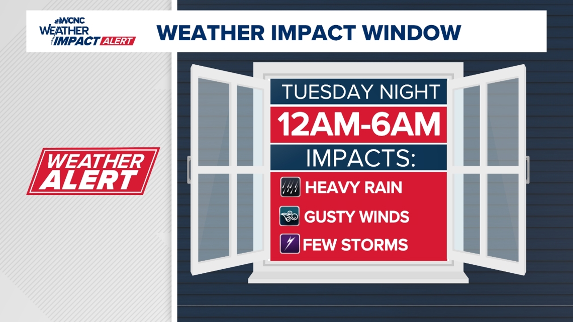
When storms arrive:
A warm front will lift north through the Carolinas on Tuesday. That just means warmer, more humid air will be moving into the region. This will provide fuel for storms. That moisture, combined with some upper-level energy moving through the atmosphere, could lead to the development of strong to severe storms.
Starting Tuesday Evening between 6 p.m. and midnight, an isolated shower or storm ahead of the main system will begin.
Overnight into Wednesday between midnight and 6 a.m., storms will push eastward from the mountains and toward Charlotte.
By 6 a.m. Wednesday morning, rain showers gradually clear. It will be windy at times with gusts over 30 mph in Charlotte and over 40 mph in the western North Carolina mountains. The gusty winds will continue through Friday.
On Thursday behind the cold front, rain will bring in much cooler drier air with high temperatures in the middle 70s.


Impacts of storms:
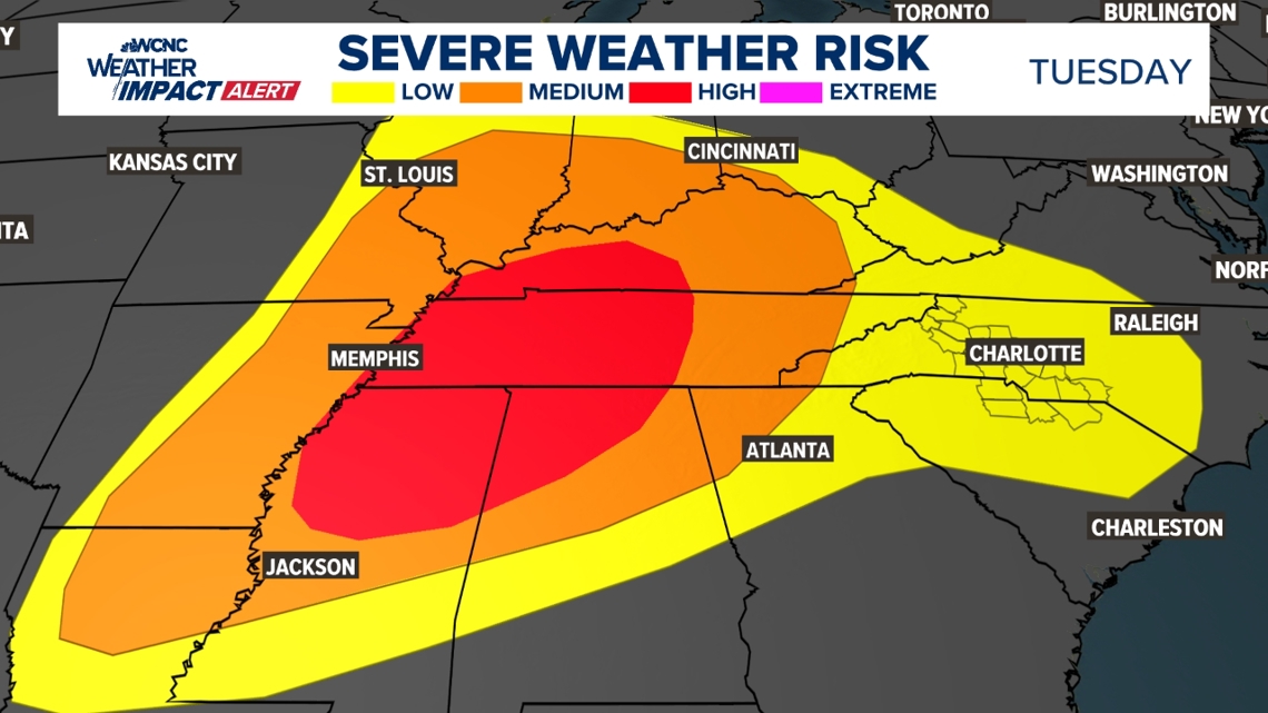
The primary threats are 60 mph damaging winds, one-inch hail, heavy rain, and frequent lightning. Tornado threat is low, but a quick spin-up, especially in the mountains, is possible.
What you need to stay safe:


