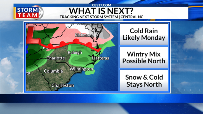
RALEIGH, N.C. (WNCN) — We are still monitoring a storm system that will arrive in central North Carolina late Sunday and early Monday — so will it snow?
The short answer is likely not this go around. However, a wintry mix is still possible near the Virginia state line early Monday morning.

TIMING: late weekend-early next week
A winter storm is expected to begin impacting the Central Plains on Saturday night, with heavy snow and icing potential spreading east to the Mid-Atlantic by early next week. Major travel disruptions will be possible starting this weekend in parts of the lower 48 states.

Here in the Triangle, we are likely to see just cold rain on Monday night as we’ll be in the warmer sector of the storm system. Uncertainty remains regarding the exact storm track and timing, which could lead to slight changes as the storm develops, but the highest impacts will stay north and west of North Carolina.

JANUARY COLD
The first month of the year will be very cold with highs in the 30s and 40s through at least January 15th. While the cold will be here, what about the moisture to bring us the snow?

The Climate Prediction Center forecasts the next 8 to 14 days to be drier than average.

The last measurable snow in the Raleigh area was 1068 days ago.


