Winter can bring snow and ice in a variety of different ways and intensities. One of the most treacherous is accumulating ice.
HICKORY, N.C. — The freezing rain that fell on January 6, 2025 was heaviest in Virginia, but one of the biggest ice threats the Mid-Atlantic has had in a couple of years. Here is how freezing rain and ice form along with all of the different types of winter weather in this Weather IQ.
Freezing Rain:
Freezing rain falls as super-cooled droplets that instantly refreeze on contact with anything below 32 degrees at the surface. From ranging from 2 thousand to 10 thousand feet up in the atmosphere, the temperature can for a variety of reasons warm above freezing. This melts any falling snow above this level into water droplets. But the cloud dynamics of these droplets, allow them to freeze almost instantaneously to the surface.
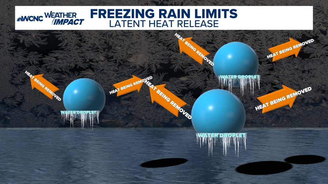
Freezing rain is self deprecating. Meaning, if temperatures are near freezing, it will often be limited due to what is called latent heat release. When water freezes, it gives back heat to the atmosphere. So after time, temperatures could warm back above freezing, ending the ice event. But if temperatures are in the 20s, not a lot can be done to limit ice accumulation.


When freezing rain lasts for several hours, it becomes an ice storm.
An Ice Storm Warning means over a quarter inch of ice is possible but more commonly any ice event will be covered by a Winter Weather Advisory if there is a chance for accumulation ice and up to a quarter inch potential will have a Winter Storm Warning issued. Over a half inch of ice can snap power lines leading to widespread power outages. An ice storm is the most dangerous winter weather to drive in and it even makes walking treacherous.
Other icy precipitation types:
When snow falls through layers of air that are above freezing, three different things can happen.
Graupel, which is also known as soft hail, happens when a snowflake has below-freezing water droplets flash freeze onto it.
Sleet forms when snowflakes partially melt and then refreeze into ice pellets near the surface. These ice pellets can accumulate greatly into
Snow:
Falling snow has several names. Snow flurries means that just a little snow is falling over a short period of time. A light dusting is the most you will see.
Snow showers can vary in intensity. They are heavier than flurries, but these also don’t last long. Snow accumulations can range from a coating to a couple of inches.
The heaviest snow bands are called snow squalls. Snow squalls are brief but intense snow showers that accompany gustier winds. Snow accumulations can be significant.
These are most common around the Great Lakes during Lake effect storms.
A snow storm can bring a combination of snow showers and snow squalls across a longer time period. Strong winds can blow snow, cause snow drifts, reduce visibilities and make driving treacherous.
A blizzard has a specific criteria:
- It must last three hours or longer
- Have sustained or frequent gusts to 35 mph or greater
- Considerable falling or blowing snow needs to reduce visibilities to less than a quarter mile
Contact Chris Mulcahy at cmulcahy@wcnc.com and follow him on Facebook, X, Instagram and TikTok.


