


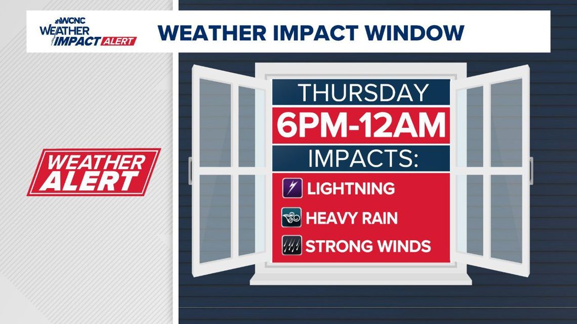
The primary threats associated with these storms will be lightning, heavy rain and strong winds.
CHARLOTTE, N.C. — WCNC Charlotte’s Weather Impact Team wants everyone in the Charlotte area to be weather alert due to the risk of strong-to-severe thunderstorms Thursday evening.
Weather Impact meteorologist Chris Mulcahy says these storms will have the potential for heavy rain, hail, damaging winds and flash flooding.
When
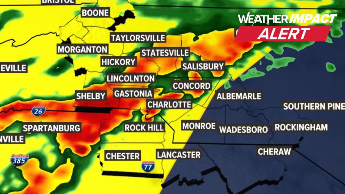
The first wave of storms is expected to impact the foothills and areas west of Charlotte around 6 p.m. Thursday. Impacted areas include Hickory, Lenoir, Morganton, Newton, Shelby and Valdese.
Mulcahy says the window for severe weather will extend from 6 p.m. until around midnight for the Charlotte metro. Showers are expected to continue overnight into Friday morning, but there’s a much smaller threat for severe weather during Friday’s rain.


Impact
The primary threats associated with these storms will be lightning, heavy rain and strong winds. Some areas in the foothills could also get hail as the front arrives in the late afternoon to evening. Meteorologist Majestic Storm says there isn’t any concern for possible tornadoes, but gusty winds could take down trees or damage buildings.
Need
Have a plan for any outdoor activities, as storms could disrupt any event during this time.
Download the WCNC Charlotte app for the latest forecast and real-time severe weather alerts. Chief Meteorologist Brad Panovich and the entire Weather Impact team will have regular updates through Thursday night.
Worst places to be during lightning:
- Open fields, on top of a hill
- Near tall, isolated trees
- Near water or metal
Best place to be:
- Inside a car
- Inside a building


