


When fires begin in rural areas, weather satellites in space are often the first to detect new smoke plumes.
CHARLOTTE, N.C. — The East Coast of the United States is getting a new watchful eye over its skies as the National Ocean and Atmospheric Administration prepares to turn weather observations over to a new satellite.
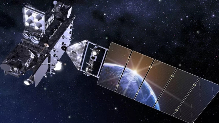
The new satellite launched on June 25, 2024, and has been in testing for the past nine months. It will replace the old satellite, which launched on Nov. 19, 2016.
Why satellites
Satellites provide meteorologists the ability to track the world’s weather. It allows the detection of storm systems and threats that may not be detected by radar and other tools. One such example is hurricanes, which are only often visible only by satellites until they move to within range of land-based radars on the coast.
Satellites can also be used for a handful of other tasks, such as monitoring solar radiation from the sun and spotting smoke from nearly-formed wildfires.
Satellites detecting wildfires
Satellites are critical as the Carolinas enters a highly active wildfire season. Helene left an abundance of downed trees and storm debris deep into the forests of the Carolinas. With mountainous regions often leaving lumber and vegetation in the hard-to-reach areas of both North Carolina and South Carolina, it can be satellites that often first to detect the smoke of flames of a new wildfire.
Detecting fires from space
The first time a NOAA scientist detected a wildfire on a weather satellite was in 1980, when Michael Matson and Jeff Dozier, who were working at NOAA’s National Weather Service building in Camp Springs, Maryland, detected tiny bright spots on a satellite image of the Persian Gulf. The image had been captured by the Advanced Very High Resolution Radiometer (AVHRR) instrument on the NOAA-6 satellite. The spots they discovered were campfire-sized flares caused by the burning of methane in oil wells, according to NOAA.
Despite being named “high resolution” for the time period, every generation of new weather satellites has improved upon the previous generation.
What’s in a name?
NOAA uses a series of names to represent the same spacecraft. Before launch, this latest satellite was known by a letter, GOES-U. Once in orbit, the letter was swapped for a number and it became known as GOES-19. And finally, the satellite will most commonly be known as GOES-EAST, which represents the operational region it serves.
GOES is NOAA’s current generation of satellites and stands for Geostationary Operational Environmental Satellites.
GOES-19
When GOES-19 becomes operational over the East Coast on April 2, its Advanced Baseline Imager (ABI) scans the globe every five minutes. When it displays an image, a single pixel could represent an area as small as a third of a mile. That again, is considered to be “high resolution” for the current generation of weather satellites. In some instances, NOAA credits the satellite technology with spotting smoke before a human has even spotted the fire.
NOAA’s next-generation
GOES-19 is the last in NOAA’s GOES series. The new generation will be known as GeoXO. NASA, on behalf of NOAA, awarded Lockheed Martin with the contract to construct the $2.27 billion program.
The future satellite technology is expected to improve the resolution of wildfire smoke detection by a factor of four.
AI-powered wildfire detection
Government agencies are not alone in space. With the advent of private spaceflight and artificial intelligence, more companies are launching satellites into space. A new collaboration between Earth Fire Alliance and Muon Space is launching a series of satellites that will use AI to detect wildfires. With support from Google, Gordon and Betty Moore Foundation, the Environmental Defense Fund, and others, the group has launched a prototype satellite this month.
“The devastating wildfires in Los Angeles earlier this year underscore the urgent need for real-time, high-fidelity infrared data to protect lives, communities, ecosystems, and economies,” Brian Collins, the executive director of the Alliance, sad in a statement. “The launch of the FireSat protoflight is a critical step toward a future in which wildfires are better understood, monitored, and mitigated.”
Earth Fire Alliance’s first three operational FireSats are scheduled to launch in 2026, with the full constellation of 50+ satellites to be built out by 2030. They’re expected to take pictures of the globe every 20 minutes and to use AI for analysis. Funding for the constellation’s first satellite comes in part from AI Collaboratives: Wildfires, an initiative created by Google.org. Google.org provided $13 million to support the launch of the first satellite in the FireSat constellation.
