(WGHP) — Welcome to meteorological fall!
Meteorological fall started on Sept. 1. Meteorological seasons are based on temperature cycles instead of the astronomical seasons that most people go by.
We saw some big swings this summer.
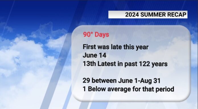
It took a while for our first 90-degree day. It did not arrive until June 14 and was the 13th latest first 90-degree day since 1903.

Once we had our first, the numbers grew quickly, and we finished June with 10, two above normal.
July had 13 which was exactly normal.
August numbers dropped off due to so many cloudy days and an unusually strong cold front that brought a break from summer heat late in the month.
We finished with 29 90-degree days between June 1 and Aug. 31, which was one day below normal.
Another big swing was the rainfall.

June was very dry with only 0.92 inches of rainfall, more than 3 inches below normal. It came in as the fourth driest June in the past 122 years.
All of our yards were brown, and the soil was cracking. Then, July came, and it started raining. We had 9.56 inches in July, 5.38 inches above normal, and that wiped out the drought.
August continued that trend with another 9.11 inches, 4.75 inches above normal.
July to August alone had 18.67 inches, and it was the fourth wettest in the past 122 years. Meteorological summer saw 19.59 inches of rain and finished as the 15th wettest since 1903, an amazing feat given such a dry start.
So it was a summer of extremes. Our temperature for the entire summer was 0.5 degrees above normal, which made this summer our 16th warmest in the past 122 years.

Our hottest day was 99 degrees on July 15. That ranks as the 26th hottest summer maximum since 1903.
Our coolest temperature was 52 degrees on June 1 and ranks as the 63rd coolest out of 122, so that was actually very close to normal.
Be on the lookout for FOX8 Meteorologist Alex Schneider’s fall outlook story.


