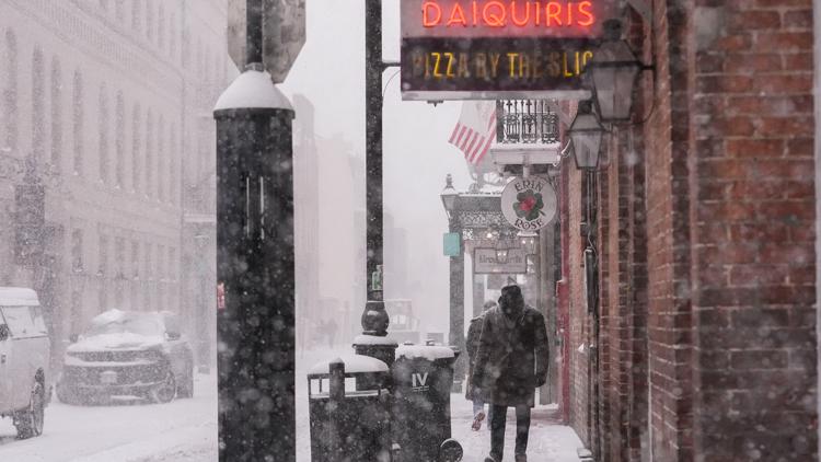
From Florida to Texas, large chunks of the southern United States were blanketed in snow Tuesday during a historic snowstorm.
WASHINGTON — A major winter storm in the southern U.S. brought record-breaking snow and ice to areas traditionally unused to below-freezing temperatures, including Georgia and Louisiana. The storm canceled more than 1,300 flights, disrupted work and transportation, and killed at least three people.
Dangerous below-freezing temperatures with even colder wind chills were expected to last over much of the week in the region. The heavy snow, sleet and freezing rain reached into the Deep South as a blast of Arctic air plunged much of the Midwest and the eastern U.S. into a deep freeze.
The snow and ice closed highways — including more than 100 miles of the nation’s southernmost interstate, I-10, in Louisiana and Florida. Hundreds of flights were grounded at multiple airports. School was canceled or switched to remote learning for more than a million students who are more accustomed to hurricane dismissals than snow days.
Dawn found highways and surface roads across most of Georgia deserted, with traffic cameras showing street lights glinting off an icy glaze in many locations. The dull roar of rush hour freeway traffic was absent from suburban Atlanta. The danger of travel in a region generally unaccustomed to such weather was evident in Savannah, where it snowed overnight and a jackknifed truck closed part of the interchange between Interstate 16 and Interstate 95.
Snow fell in Houston and prompted the first ever blizzard warnings for several coastal counties near the Texas-Louisiana border. Snow covered the white-sand beaches of normally sunny vacation spots, including Gulf Shores, Alabama, and Pensacola Beach, Florida.
“Believe it or not, in the state of Florida we’re mobilizing snowplows,” said Florida Gov. Ron DeSantis.
People made the most of it — from a snowball fight on a Gulf Shores beach to sledding in a laundry basket in Montgomery, Alabama, to pool-tubing down a Houston hill. New Orleans residents took part in an unusual French Quarter activity to celebrate the whiteout, engaging in a Bourbon Street snowball fight.
How much snow did places in the South get?
Here are the snow totals for some of the hardest-hit areas across the southern United States:
- Duval County – 1.0″ – 2.0″
- Baker County 1.0″ – 3.0″
- Nassau County 2.0″ – 4.0″
- Clay County 1.0″
- Columbia County 1.0″ – 2.0″
- Ware County 4.0″ – 8.0″
- Glynn County 1.0″ – 4.0″
- Pensacola 4.0″ – 6.0″
- Tallahassee 1.0″ – 3.0″
- Panama City 6.0″ – 8.0″
- 7 miles N of Austin: 0.8 inches
- 9.7 miles NNW of Austin: 0.8 inches
- 3 miles SSW of Jollyville: 0.7 inches
- 0.6 miles NE of Tanglewood Forest: 0.5 inches
- 1.4 miles SSW of Leander: 0.5 inches
- 9.8 miles WSW of Austin: 0.5 inches
- 4 miles W of Tanglewood Forest: 0.5 inches
- 2.9 miles E of Tanglewood Forest: 0.5 inches
- 0.4 miles ESE of Lakeway: 0.5 inches
- 2.0 miles NNE of Lago Vista: 0.5 inches
- 2 miles SSE of Sunset Valley: 0.5 inches
- 1 mile WNW of Onion Creek: 0.5 inches
- 5.6 miles WSW of Austin: 0.4 inches
- 2.3 miles SW of Anderson Mill: 0.4 inches
- 3 miles NW of Tanglewood Forest: 0.4 inches
- 3 miles NNW of Austin: 0.4 inches
- Austin Bergstrom Internation Airport: 0.3 inches
- 4 miles WNW of Leander: 0.2 inches
- 4 miles NNE of Austin: Trace
- Lakeway: Trace
- 2 miles SSE of Sunset Valley: Trace
- Bee Cave: Trace
- 2 miles N of Sunset Valley: Trace
- 5 miles SSE of Jollyville: Trace
- Taylor: 1 inch
- 6.7 miles NNW of Georgetown: 0.9 inches
- 0.3 miles NNW of Round Rock: 0.3 inches
- Leander: 0.1 inches
- 1.2 miles N of Liberty Hill: Trace
- 6.5 miles W of Bastrop: 0.6 inches
- 2.2 miles WNW of Bastrop: 0.5 inches
- 0.8 miles WSW of Bastrop: 0.4 inches
- 0.8 WNW of McDade : 0.4 inches
- 7.9 miles WNW of Johnson City: 0.8 inches
- 4.4 miles NW of Spicewood: 0.3 inches
- Marble Falls: Trace
- 3.9 miles ENE of Burnet: Trace
- Burnet: Trace
- 2.3 miles W of Burnet: Trace
- 5.2 miles SSE of Lockhart: 1.2 inches
- 1.0 mile SSW of Luling: 0.5 inches
- Luling: 0.5 inches
- La Grange: 1 inch
- 3.5 miles ENE of La Grange: 0.7 inches
- 0.2 miles NNW of La Grange: 0.5 inches
- 3.6 miles ENE of Wimberley: 1 inch
- 0.5 miles SSW of Woodcreek: 0.8 inches
- 2 miles NNW of Henley: 0.7 inches
- 5.3 miles WNW of Wimberley: 0.6 inches
- San Marcos: 0.6 inches
- 3.9 miles WNW of Buda: 0.6 inches
- 2.8 miles WSW of San Marcos: 0.5 inches
- Dime Box: 0.5 inches
- 1.9 miles WSW of Buchanan Dam: Trace
- Houston: 3-4 inches
- Liberty: 3-4 inches
- Anahuac: 3-4 inches
- Sugar Land: 2-3 inches
- Livingston: 1-2 inches
- Wharton: 1-2 inches
- Galveston: 1-2 inches
- College Station: Less than 1 inch
- Rockdale: Less than 1 inch
- Smithville: Less than 1 inch
- Brenham: Less than 1 inch
- Bay City: Less than 1 inch
- Atlanta – 1.1″
- Barnesville – 1.5″
- Covington – 1.3″
- Decatur – 0.8″
- East Griffin – 0.8″
- Fayetteville – 1.0″
- Hollonville – 1.3″
- Monroe – 0.8″
- Newnan – 0.8″
- Sharpsburg – 1.0″
- New Orleans – 10.0″
- Kenner – 8.0″
- Gretna – 5.0″
- Thibodaux – 8.5″
- Violet – 7.0″
- Norco – 7.8″
- Hahnville – 8.0″
- Destrehan – 3.0″
- Gramercy – 7.0″
- Lutcher – 6.5″
- Laplace – 5.0″
- Mandeville – 5.8″
- Abita Springs – 5.0″
- Pearl River – 5.0″
- Covington – 5.0″
- Slidell – 6.8″
- Pearl River – 6.0″
- Lacombe – 5.5″
- Ponchatoula – 6.0″
- Hammond – 4.0″
- Houma – 7.8″
- Bayou Cane – 5.5″
- Bogalusa – 4.0″
- Waveland – 6.0″
- Diamondhead – 4.8″
- Kiln – 2.8″
- Biloxi – 5.0″
- Gulfport – 5.3″
- Pass Christian – 3.0″
- Picayune – 5.1″


