


Expect daily scattered showers and storms starting Tuesday, with rainfall potentially reaching 1-2 inches by the weekend.
CHARLOTTE, N.C. — Monday marked the 10th straight day without measurable rainfall in Charlotte, but that is coming to an end Tuesday. Rain has already filled up most of the morning for the North Carolina mountains and now round one will be here in the Charlotte area Tuesday afternoon.
When
Tuesday through Saturday there is a chance for rain at least in one part of the day, with most of the activity happening in the afternoon.
Let’s start with round one and the low-end severe weather chance. Most will be just dodging rain but there will be a few thunderstorms this afternoon with some becoming strong to severe.
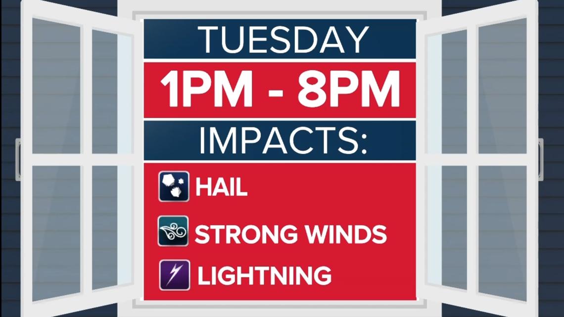
Tuesday afternoon is currently our only Weather Alert period this week from 1 to 8 p.m. During this time, isolated storms could pop and combine into clusters of storms, which could elevate the gusty wind risk.

- Wednesday late morning to Wednesday afternoon is the next pulse of showers and storms with areas south and southeast of Charlotte in line for heavier rain and thunderstorms
- Thursday currently has the slowest-moving rain and the best chance to have more wet hours than dry ones in the afternoon
- On and off rain then continues Thursday night through Saturday night before drying out just in time for Sunday
Impacts
Tuesday: Right now, gusty winds is the primary threat but some of these storms could dump quick hail on the region. Hail sizes could range from pea to nickel being most likely. There is an outside chance of larger hail. This time of year is more conducive to hail because there is a lower freezing level. Of course, dangerous lightning will be a possibility as always along with a heavy downpour.
Rainfall totals through the weekend could reach 1 to 2 inches, which would go a long way toward helping alleviate our growing rainfall deficit. Not everyone will see rain every day, but most of the Charlotte area will get in on at least some of the action over the next several days. Right now, different sections of the viewing area will have heavy rain at different times. If some areas are getting soaked more than others, our flash flooding risk goes up.
Thursday right now has the best potential for the most widespread rain meaning more people see it for a longer period of time.
As for severe weather, the risk remains low overall, but we can’t completely rule out a few stronger storms.
The bottom line: it’s going to feel more like spring this week—warm, muggy, and stormy at times.
How to stay safe
Make sure you’re staying Weather Alert and checking in with the WCNC Weather Impact Team’s forecast updates. WCNC Charlotte will be tracking each system as it moves in, helping you plan around the rain while keeping you safe from any stronger storms that develop. The easiest way to do this is to download our streaming channel WCNC+ where we’ll be giving constant weather updates.
RELATED: Stream WCNC+ now
