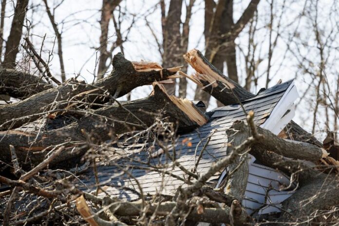
(AP) — Potentially deadly flash flooding, high-magnitude tornadoes and baseball-sized hail could hit parts of the Midwest and South on Wednesday as severe thunderstorms blowing eastward become supercharged, forecasters warned.
There were already tornado warnings Wednesday morning near the Missouri cities of Joplin and Columbia — merely the opening acts of what forecasters expect will be a more intense period of violent weather later Wednesday, as daytime heating combines with an unstable atmosphere, strong wind shear and abundant moisture streaming into the nation’s mid-section from the Gulf.
The potent storm system will bring “significant, life-threatening flash flooding” starting Wednesday and continuing each day through Saturday, the National Weather Service said.
With more than a foot (30 centimeters) of rain possible over the next four days, the prolonged deluge “is an event that happens once in a generation to once in a lifetime,” the weather service said in one of its flood warnings. “Historic rainfall totals and impacts are possible.”
The flood fears come as residents in parts of Michigan continued to dig out from a weekend ice storm.
Floods could inundate towns, sweep cars away
Thunderstorms with multiple rounds of heavy rain were forecast in parts of Texas, the lower Mississippi Valley and the Ohio Valley beginning midweek and lasting through Saturday. Forecasters warned the storms could track over the same areas repeatedly and produce heavy rains and dangerous flash floods capable of sweeping cars away.
Rain totaling up to 15 inches (38 centimeters) was forecast over the next seven days in northeastern Arkansas, the southeast corner of Missouri, western Kentucky and southern parts of Illinois and Indiana, the weather service warned.
“We’re potentially looking at about two months of rain in just a handful of days,” Thomas Jones, a weather service meteorologist in Little Rock, Arkansas, said Monday.
Parts of Arkansas, west Tennessee, western Kentucky and southern Indiana were at an especially high risk for flooding, the weather service said.
Tornado seen in Kansas and more could be coming
At least one tornado was spotted Tuesday night in Kansas. “Take cover now!” the weather service’s office in Wichita warned residents on the social platform X.
No injuries were reported from the Kansas twister. Tornado warnings were also issued in Missouri on Wednesday, but there were no immediate reports of damage or injuries as a result of those.
Along with tornadoes, high winds with gusts of up to 50 mph (80 kph) were also expected across large parts of the Midwest.
The ominous forecast comes nearly two years to the day that an EF-3 tornado struck Little Rock, Arkansas. No one was killed but that twister caused major destruction to neighborhoods and businesses that are still being rebuilt today.
More than 90 million people are at some risk of severe weather in a huge part of the nation that stretches from Texas to Minnesota and Maine, according to the Oklahoma-based Storm Prediction Center.
Strong and long-lasting tornadoes appear likely in highest-risk area
About 2.5 million people are in a rarely-called “high-risk” zone. That area most at risk of catastrophic weather on Wednesday includes parts of west Tennessee including Memphis; northeast Arkansas; the southeast corner of Missouri; and parts of western Kentucky and southern Illinois.
A tornado outbreak was expected Wednesday, and “multiple long-track EF3+ tornadoes, appear likely,” the Storm Prediction Center said. Tornadoes of that magnitude are among the strongest on the Enhanced Fujita scale, used to rate their intensity.
At a slightly lower risk for severe weather on Wednesday is an area that includes Chicago, Indianapolis, St. Louis, Louisville, Kentucky, and Little Rock, Arkansas. Dallas, Detroit, Milwaukee, and Nashville, Tennessee, were also at risk.
Wintry mix blasts Upper Midwest
In Michigan, crews worked to restore power after a weekend ice storm toppled trees and power poles. More than 135,000 customers in northern Michigan and 11,000 in northern Wisconsin were still without electricity Wednesday morning, according to PowerOutage.us, which tracks outages nationwide.
Schools in several counties in Michigan’s the mitten-shaped Lower Peninsula have been closed as deputies used chain saws to clear roads and drivers lined up at gas stations. And more wintry weather was on the way: A mix of sleet and freezing rain could keep roads treacherous into Wednesday across parts of Michigan and Wisconsin, the weather service said.
Heavy, wet snow was also forecast into Wednesday across the eastern Dakotas and parts of Minnesota.


