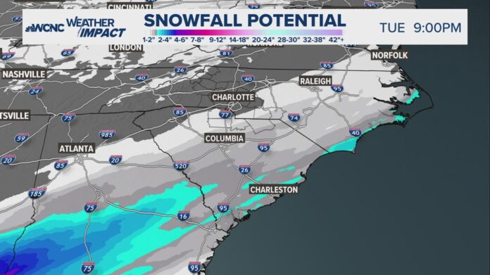
Charlotte could see a few flurries but Charleston, South Carolina could see a Top 5 snowfall event.
CHARLESTON, S.C. — In recent years, Charlotte, North Carolina has been waiting and lacking snow. The snow that fell on Jan. 10 of this year finally broke the 1,077 day streak without snow. Charlotte has been too far south and too warm for most of the snow chances between now and January 2022, when three years ago the city saw back-to-back-to-back weekends with snow.
But this time… Charlotte isn’t too far south. The city is too far north.
Why Charleston will see more snow than Charlotte
During the winter months, a low-pressure weather system will typically produce the heaviest snowfall about 100 miles north of its center location. That’s why Charlotte is typically too far south for snow.
However, this weather setup is uniquely different. When the low pressure is over water, it can be as much as 200 miles north of the center that experiences impacts from the heaviest snow. That is the case for this setup.
The further north you get from a low, the drier the air. In this scenario, a cold front is also aiding this system to remain well south of the Carolinas but just enough to our north to bring a significant snowfall to the South Carolina shoreline.
This area also has a lot of moisture, which increases the snow rates and leads to greater accumulations.
The last big snow around Charleston


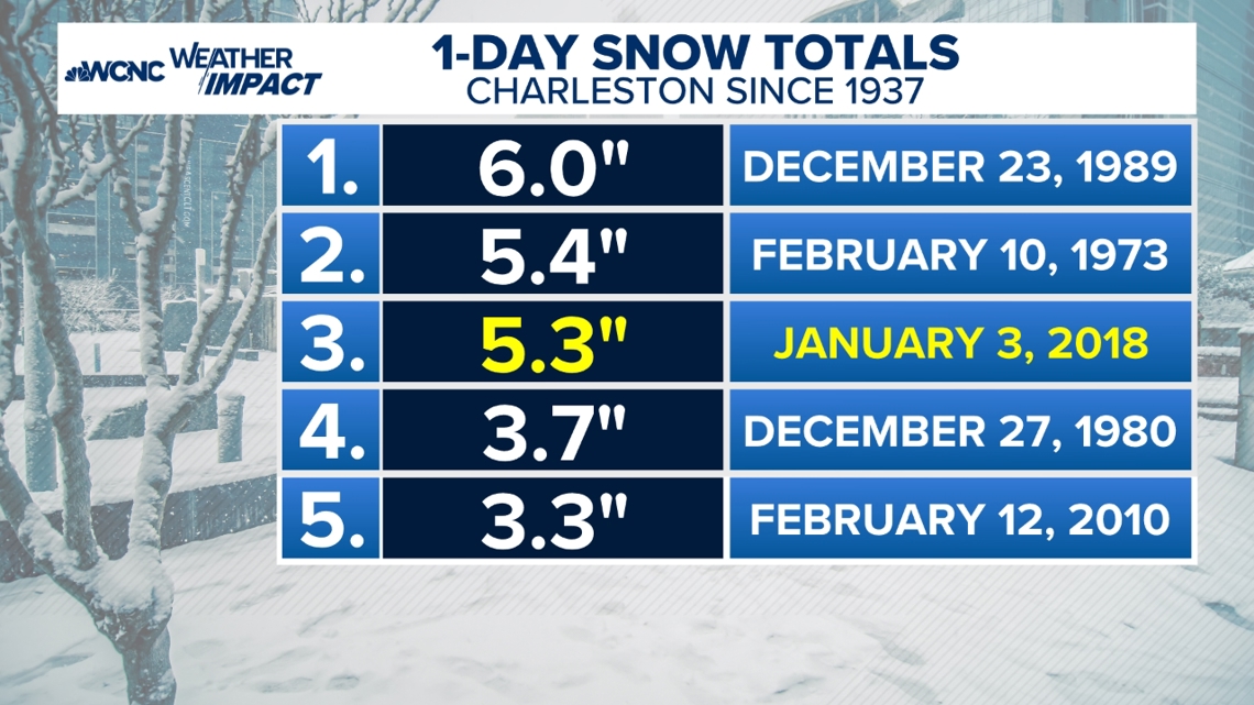
The January 21 snow event in Charleston could make the list of the Top 5 snowfall events.
In most recent memory, a weather setup back in 2018 produced snow for the city but is different than its challenger in 2025. This path was a more north-to-south movement compared to a low-pressure system moving southwest-to-northeast.
Here is what was needed for this historic snowfall:
- Cold, freezing air in place beforehand
- A low-pressure system originating in the Gulf
- Lots of moisture in the northern part of the low-pressure system
- The low-pressure system has to be the right distance south or southeast
What Charlotte needed for a bigger snow?
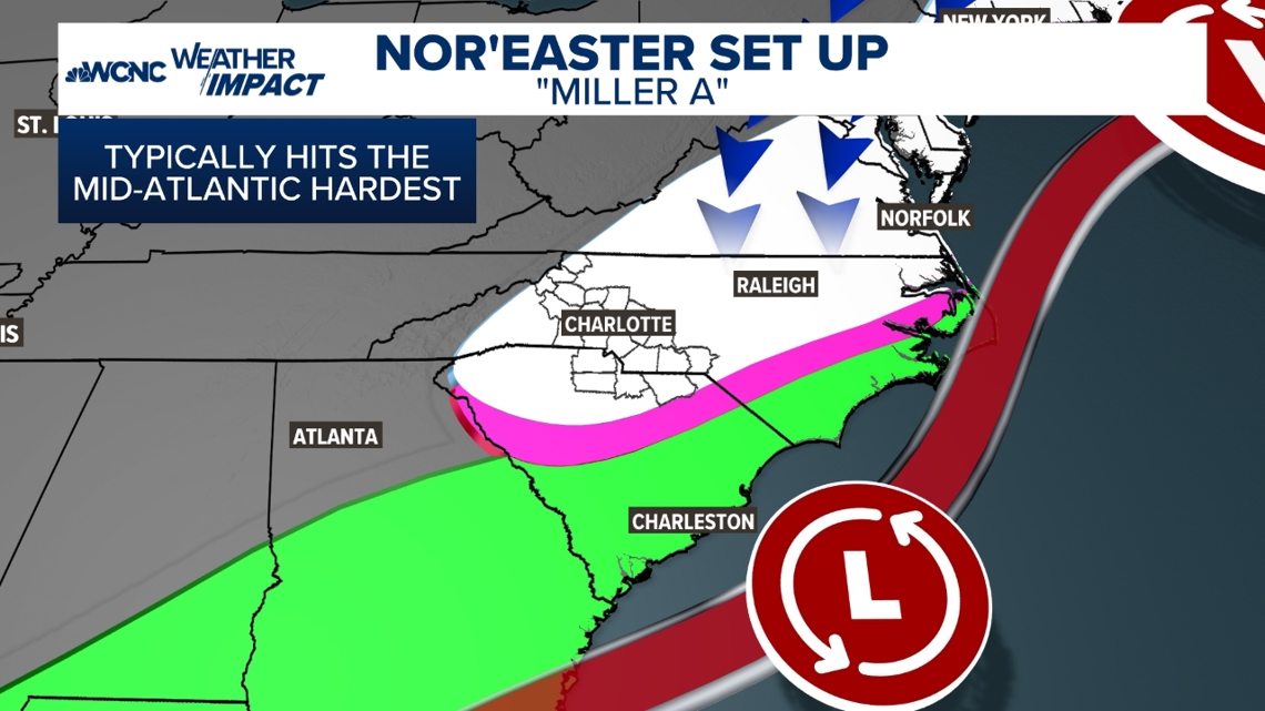
Plain and simple… This low pressure needed to be between 150 and 200 miles further north. The image below is the ideal Nor’easter setup that impacts the Mid-Atlantic states the hardest.


For Charlotte to likely see the biggest snow impacts, the low needs to pass directly over Charleston.
The last big Charlotte snowstorm back in 2004 had this set up.


