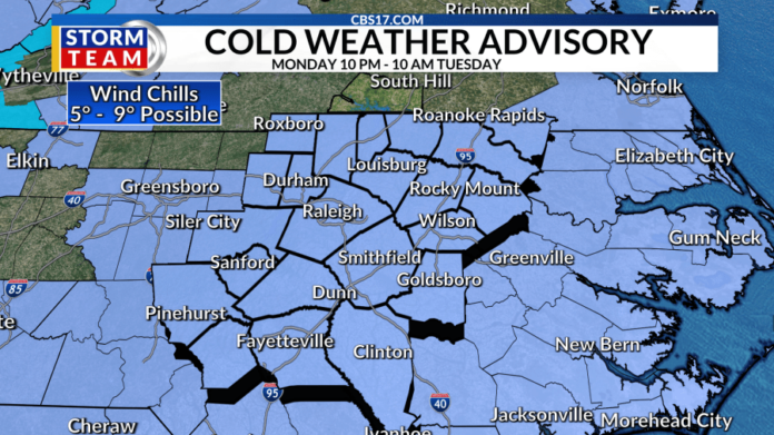
RALEIGH, N.C. (WNCN) – The arctic cold front and cold air arrived Sunday night and that will set the stage for the chance of snow and central North Carolina getting the coldest air so far this season for the upcoming work week.

ALERT: The trend over the past 24 hours has been for the snow totals to come down, but there could still be hazardous travel Tuesday night into Wednesday morning and the CBS 17 Storm Team has declared an ALERT DAY for that reason.
This is an unusual setup for central North Carolina in that the higher amounts of snow could be in the Sandhills and along the coast, but also because the rain-snow line will likely set up over the coast and not central North Carolina.

The updated snow forecast totals are now more likely a trace of snow up to 1″, down from the 1″-3″ earlier. Higher impacts will be more likely near Interstate 95 and east, and between 1″ and 2″.
Snow is expected to move in around 8 p.m. Tuesday and end by around 4 a.m. Wednesday. The short duration of the event and the fact the low moisture could be farther away is why the snow forecast totals have trended lower.
The storm system hasn’t developed yet but will get organized in the Gulf of Mexico late Monday before moving into the Carolinas Tuesday night.
Unlike the winter event a week ago, this one will likely be all snow, with just a slight chance of some mixing (sleet) along and east of I-95.

Our short-range computer forecast model is hinting as western portions of our viewing area being the cutoff for snow. However, there is still some disagreement with how far northwest the snow bands will set up.
The two main long-range forecast models, the European and American, have vastly different solutions, especially considering we’re only a day and a half away. While the European favor some snow, the American GFS model takes the low farther away, bringing essentially no snow to us. That’s an unlikely solution, but can’t entirely be ruled out.

This will not be a typical North Carolina snow event. With so much cold, arctic air in place, the snow that will fall will be light and fluffy, not the slush we got a week ago. Meteorologically, the colder the temperatures get, the higher the snow-to-liquid ratio becomes, essentially, the fluffier the snow gets.

It’s been over six years (Dec. 9-10, 2018) since the last 3+” snow event in the Triangle. While we likely won’t get there in the Triangle, areas closer to the coast could pick up three inches or more!


