RALEIGH, N.C. (WNCN) — The 1st measurable snow in nearly 3 years is happening and could cause road problems this weekend, so the CBS 17 Storm Team has issued a Weather Alert Day Friday & Saturday.
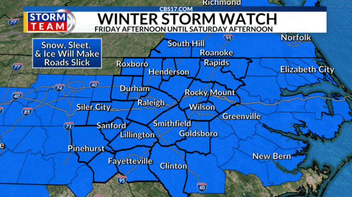
A Severe Winter Storm Watch has been issued for all of central North Carolina for Friday afternoon through Saturday afternoon. Snow, sleet, and ice will mix into the area and could cause slick roads, bridges, and overpasses.

While it won’t be a full-blown winter wonderland, it’s looking like we’ll get enough snow to end the second-longest snow drought in Raleigh history.
It has been 1075 days since measurable snow in the Triangle. We need at least .1″ of snow to end the drought.

TIMING: Friday night – Saturday Morning
Snow is expected to begin Friday afternoon after 4 p.m. and it will start as snow for everyone before changing over after midnight for some to a wintry mix of rain, snow or ice. The snow is expected to stick and cause some travel problems Friday night through Saturday morning.
The system will wrap up and the snow will move out around 6 a.m. Saturday, but roads could still be tricky to travel on through the afternoon Saturday.

IMPACTS: Snow, ice, and cold rain possible
The cold temperatures this week will have an impact on snow accumulation and road conditions, but the fact that sleet, freezing rain, and rain could mix in will make it a difficult forecast and possibly disrupt travel through early Saturday.

Early snowfall accumulation forecasts put us between 1 to 2 inches in the Triangle, Up to 3 inches along the I-85 corridor, and less than 1 inch southeast of the Triangle.

Ice accumulation could be anywhere from a glaze to a tenth of an inch. Icy roads will be possible Friday night, Saturday morning, and maybe Sunday morning. Remember, a slight shift in the storm’s track could mean a big difference in totals, so we’ll have to fine-tune totals as we get closer.

High-resolution model data has a more southern track and weaker system moving through, putting snow in the Triangle after 6 p.m. the evening commute on Friday, before switching to a mix overnight into Saturday south and east.

LOW-PRESSURE TRACK MATTERS
This is a traditional setup for snow in central North Carolina, but it is heavily dependent on the track of the low pressure. The farther south the low-pressure tracks, the better chance of snow in the Triangle.
If low pressure is closer to central North Carolina, that means the warmer air is closer and rain is more likely than snow. If low pressure is farther south and the warmer air is farther south, the cold air can take over and turn moisture into snow.

While wintry weather continues to look more and more likely, and the fact that we’ve had cold temperatures leading up to this event, means snow will stick and travel could be tricky on area roads.
The forecast will continue to go through changes and tweaks leading up to Friday night, check back for updates every day!


